Satellite photo of San Andres island
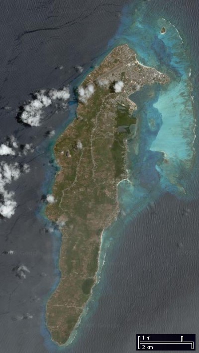
I found this excellent picture of San Andres on Google Maps. It’s such a hard island to find on the satellite maps, and such a beautiful picture that I sutured several images together to get this one. I also included a distance legend to remind myself just how small this island is. We were able to drive around the entire island in a gas-powered golf cart in about 2 hours. You can see the airstrip just at the top of the island, and it barely fits across the island’s width. Our hotel was a stone’s throw (literally) from the right end the runway.
 Previous Post